
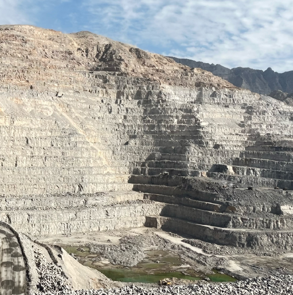

Hyperspectral imaging mining workflows have moved well beyond research demonstrations. From early-stage exploration and drill core logging to mine face mapping and ore processing, hyperspectral imaging is increasingly used as an operational tool for identifying minerals, mapping lithologies, and supporting decisions that have direct economic and environmental consequences.
The reason is straightforward: many minerals have characteristic absorption features in the visible, near-infrared, and shortwave infrared regions. A scientific-grade hyperspectral system, built around a precision imaging spectrometer, can detect and map those features at high spatial resolution, transforming a visual scene into a quantitative mineralogical dataset. For mining operations, that means earlier insight, fewer misclassifications, and better-targeted sampling across the value chain.
Why Hyperspectral Imaging Belongs in Modern Mining
Traditional mining workflows rely heavily on visual logging, geochemical assay, X-ray diffraction (XRD), and other established laboratory methods. These remain essential. But they are also relatively slow, sample-limited, and often destructive. The pressure to extract more value from each project — while reducing waste, energy use, and environmental footprint — has created a clear need for faster, non-destructive, and spatially detailed mineral characterization.
Hyperspectral imaging mining applications respond directly to that need. Instead of producing only a visual record, a hyperspectral imaging system records a continuous spectrum for every pixel in the scene. Subtle differences in mineralogy, alteration, weathering, and contamination that may be invisible to the naked eye become measurable. That capability can be used at every stage of the mining process, from regional exploration to operational decision-making at the mine face.
It is important to be clear about scope: hyperspectral imaging does not replace assay or XRD. It complements them. The most effective workflows combine spectral imaging with traditional geochemical and mineralogical methods, with each technique contributing what it does best.
The Spectral Fingerprints of Minerals
Mineralogy expresses itself in light. Different minerals reflect, absorb, and scatter light in patterns that depend on their crystal structure and chemical bonds, and those patterns are often most distinct outside the visible spectrum.
In the visible and near-infrared (VNIR) region (roughly 400–1000 nm), iron-bearing minerals show characteristic absorption features. Hematite, goethite, jarosite, and other iron oxides and hydroxides display recognizable spectral signatures that can be used to map weathering surfaces, gossans, and iron alteration zones.
In the shortwave infrared (SWIR) region (roughly 1000–2500 nm), the spectral information becomes especially rich for clay minerals, micas, carbonates, sulfates, and hydroxyl-bearing minerals. Kaolinite, illite, montmorillonite, muscovite, chlorite, calcite, dolomite, gypsum, and many alteration minerals each leave distinct absorption fingerprints in this range. SWIR is the workhorse band for mineral exploration and alteration mapping.
Beyond SWIR, in the mid-wave and long-wave infrared (MWIR and LWIR), additional mineral groups become identifiable — particularly silicates such as quartz and feldspar, which have characteristic features in the thermal infrared. Combining VNIR, SWIR, MWIR, and LWIR data is therefore the gold standard for the most demanding mineralogical applications.
This is why broad spectral coverage matters. A camera limited to a narrow region will miss critical minerals; a system that combines VNIR and SWIR, or extends further, can characterize a much wider mineral suite within a single dataset.
Hyperspectral Imaging Across the Mining Workflow
The value of hyperspectral imaging mining applications becomes clearest when looking at the full workflow, from regional exploration to processing decisions.
Exploration and Prospecting
At the exploration stage, hyperspectral data is used to identify alteration zones, vegetation anomalies linked to subsurface mineralization, and surface mineralogy across large areas. Airborne and UAV-based hyperspectral systems are particularly powerful here, providing high-resolution spectral mapping over kilometers of terrain — a discipline covered in more depth in our overview of hyperspectral remote sensing systems. Compact UAV-compatible sensors such as the HySpex Mjolnir series make it possible to combine scientific-grade spectral performance with the operational flexibility of drone-based deployment.
Drill Core Analysis
Drill cores are the most information-dense samples in any exploration program. Hyperspectral core scanning provides a non-destructive, high-resolution mineralogical record of every meter of core, enabling automated identification of mineralization phases, alteration mineralogy, and lithological boundaries. This dramatically reduces the amount of core that needs to be sub-sampled for assay, and ensures that no information is lost when cores are reboxed or stored.
Mine Face Mapping
In active operations, hyperspectral mapping of open-pit mine faces supports near-real-time decisions about extraction segments, contamination, and material routing. Identifying clay-rich zones, sulfide ore, oxidation surfaces, or unwanted accessory minerals before extraction can reduce energy-intensive material re-handling and improve recovery.
Processing and Ore Sorting
Hyperspectral systems are increasingly used in mineral processing for online ore sorting, contamination detection, and quality control on conveyor belts. Here, robustness, speed, and integration with control systems become as important as spectral performance.
Drill Core Scanning — The HySpex Core Scanner Approach
Drill core analysis is one of the strongest application areas for hyperspectral imaging in mining, and the HySpex Core Scanner is built specifically around the requirements of this workflow.
The Core Scanner integrates HySpex VNIR and SWIR cameras with Prediktera's Breeze Geo software, delivering high-resolution mineralogical imagery across the 400–2500 nm range. Spatial resolution reaches 0.4 mm in the VNIR and 3.3 mm in the SWIR, with spectral resolution of 3.3 nm and 4.4 nm respectively. The scanning swath of 660 mm accommodates standard core boxes, drill chip boxes, loose samples, and rock mass.
What makes this combination particularly relevant for exploration teams is the analytical workflow. Breeze Geo includes publicly available USGS algorithms for mineral identification, minimum wavelength mapping, and the spectral angle mapper, alongside interactive tools for spectral library management and machine learning classification. Mineralogical interpretation can be performed in real time, with results exportable in common formats compatible with established core logging software such as IoGas, Imago, and Leapfrog.
The system was developed in close cooperation with academic and industrial partners through CASERM (Center for Advanced Subsurface Earth Resource Models), a collaborative research center led by Colorado School of Mines and Virginia Tech. That research grounding ensures the workflow reflects how exploration geologists actually work — not just what is technically possible.
Case Study: The Alaska Geological Materials Center
A useful illustration of how far hyperspectral mining workflows have advanced is HySpex's partnership with Telops to supply the State of Alaska's Geological Materials Center (GMC) with a next-generation core logging system.
The GMC curates a collection of more than 500,000 feet of unique, contiguous rock cores. Cataloging this volume of material with traditional methods is essentially impossible — but with high-throughput, non-destructive hyperspectral scanning, the collection can be digitized systematically and made publicly accessible.
The Alaska system combines HySpex Classic VNIR-1800 and SWIR-640 cameras with HyperCam Mini MWIR and LWIR cameras from Telops, yielding data cubes with a combined spectral range of 400–12,500 nm. That breadth is significant: it covers iron oxides and clays in the VNIR/SWIR, then extends into the MWIR and LWIR where silicates and other less common mineral families become identifiable. A 3D laser profiler enables spatial co-registration across all sensors, and a high-resolution RGB camera supports interpretation of fine-grained core.
The data feeds an automated IT architecture that GMC is building to process, store, visualize, and publicly share the results — including the use of augmented reality and machine learning for collaborative analysis. It is a clear example of how hyperspectral imaging is moving from one-off research deployment to operational infrastructure.
Mine Face Mapping in Open Pits
Mine face mapping is where hyperspectral data becomes operationally tactical. A representative example comes from work conducted by the German Research Centre for Geosciences (GFZ) Potsdam and the University of Potsdam at the former copper-gold-pyrite Apliki mine in Cyprus.
In that project, 36 surface samples were collected on-site and analyzed in the laboratory using HySpex Classic VNIR and SWIR cameras. Geochemical clustering identified seven distinct material groups, which were then linked to their spectral fingerprints and used to build a site-specific spectral library. That library was applied to mine face scans, producing classified maps that highlighted stockwork zones, disseminated and weathered sulfide ore, mineralized pillow lavas, smectitic-chloritic zones, and chloritic stockwork zones — all with sufficient spatial detail to be overlaid on 3D models created by structure-from-motion or LiDAR.
The same workflow allowed minimum wavelength mapping of the AlOH absorption feature between 2160 and 2220 nm, providing a direct indicator of clay content. For an operator, knowing exactly where the high-clay zones are before extraction is the difference between routing material correctly the first time and incurring costly re-handling further down the line.
Lithology Mapping for Critical Minerals
Another example illustrates how hyperspectral imaging supports the search for critical minerals such as lithium. In the Bajoca open pit in Portugal, GFZ Potsdam used HySpex Classic VNIR and SWIR cameras in the laboratory and the HySpex Mjolnir S-620 SWIR system for in-situ mine face scanning, as part of the LiGHTS project funded under the EU H2020 ERAMIN-2 network.
The work focused on identifying Li-bearing pegmatites against a background of metasediments. By building a site-specific spectral library from collected samples and applying it to the mine face data, the team was able to distinguish fresh pegmatite from chloritic metasediments, kaolinitic weathering crusts, and iron-rich surface alteration — even in a region where atmospheric absorption complicated SWIR analysis between roughly 1000 and 2000 nm.
The case is a useful reminder that hyperspectral imaging is not just for established commodities. As demand for battery metals, rare earth elements, and other critical raw materials grows, the ability to map lithology rapidly and non-destructively becomes a competitive advantage in both exploration and operations.
Key Considerations for Mining-Grade Hyperspectral Systems
Not all hyperspectral systems are suitable for mining work. A few characteristics tend to separate research-grade instruments that genuinely support mineral identification from systems that look capable on paper but fall short in practice.
Spectral fidelity and stability matter because mineralogical features can be subtle. Small shifts in band position, distorted absorption shapes, or poor calibration consistency can move a classification from "kaolinite" to "illite" — or miss the alteration zone entirely.
Broad spectral coverage is critical. A VNIR-only system will identify iron oxides but miss the clays and micas that dominate alteration mapping. SWIR coverage, ideally extending across the full 1000–2500 nm range, is essential for serious mineral work.
Low optical distortions such as smile and keystone, combined with proper Nyquist sampling, determine whether spatial and spectral features are preserved or smeared. These are detailed in the HySpex Key Quality Parameters resources and are not optional for quantitative mineralogical work. The choice of acquisition method also matters: most scientific-grade mining workflows rely on pushbroom rather than snapshot hyperspectral cameras precisely because the subtle absorption features that drive mineral identification require the spectral and spatial fidelity that scanning architectures deliver.
Calibration traceability is what ensures that data collected today can be compared meaningfully with data collected next year, across instruments and across sites. Without it, long-term monitoring becomes guesswork.
Operational robustness matters in field deployments. Mine sites and core sheds are not laboratories, and a system that drifts under temperature changes or vibration will not deliver reliable data when it is needed.
Software, Spectral Libraries, and Workflow Integration
Hardware is only half of a working hyperspectral mining solution. The software stack — for acquisition, calibration, classification, and integration with existing geological systems — determines how usable the data actually is.
The HySpex ecosystem combines its hyperspectral cameras with the Prediktera Software Suite, and specifically Breeze Geo for geological applications. Breeze Geo provides built-in spectral libraries, mineral identification algorithms, tools for building and adapting custom libraries with new geochemical knowledge, and export paths into mainstream core logging and modeling software.
For exploration teams, this matters because the workflow does not end at the spectral image. It ends when the mineralogical interpretation is part of the broader geological model — and the value of hyperspectral imaging depends on how smoothly that handoff happens.
Hyperspectral Mining Solutions from HySpex
Hyperspectral imaging in mining is no longer an emerging technology. It is a working tool used across exploration, drill core analysis, mine face mapping, and ore processing — in research projects, government programs such as the Alaska GMC, and commercial operations worldwide.
HySpex has developed scientific-grade hyperspectral imaging systems for these environments since the 1990s, with deep involvement in geological research programs, partnerships with academic and industrial collaborators such as CASERM, and a complete ecosystem covering VNIR, SWIR, and extended spectral ranges through partner integrations. From the HySpex Classic series for laboratory and core scanning work to compact Mjolnir UAV systems for airborne exploration and the dedicated Core Scanner platform with Breeze Geo, the product range is designed around how mining geologists actually work.
Discuss Hyperspectral Imaging for Your Mining Operation
Designing a hyperspectral imaging workflow for mining depends on the stage of the project, the minerals of interest, the operational environment, and how the data needs to integrate with the rest of your geological toolset. From drill core scanning to mine face mapping and exploration-scale UAV deployment, requirements vary significantly.
If your work involves mineral identification, lithology mapping, drill core analysis, or hyperspectral data integration into existing exploration workflows, a technical discussion about your specific application is often the best starting point. Feel free to contact us for more information.
FAQ – Hyperspectral Imaging in Mining
How is hyperspectral imaging used in mining?
Hyperspectral imaging in mining is used across the value chain — from regional exploration and prospecting to drill core analysis, mine face mapping, and processing. It enables non-destructive mineral identification, alteration mapping, and lithological discrimination by capturing the spectral fingerprints of minerals across visible, near-infrared, and shortwave infrared wavelengths.
What is a hyperspectral core scanner?
A hyperspectral core scanner is a system that images drill cores using hyperspectral cameras, producing a continuous mineralogical record of the core surface. Systems such as the HySpex Core Scanner combine VNIR and SWIR cameras with dedicated geological software like Breeze Geo to identify minerals, map alteration, and export results into established core logging workflows.
Which spectral range is best for mining applications?
For most mining applications, a combination of VNIR (400–1000 nm) and SWIR (1000–2500 nm) provides the broadest mineralogical coverage, capturing iron oxides, clays, micas, carbonates, sulfates, and many alteration minerals. Extended systems that add MWIR and LWIR data — for example, the HySpex–Telops platform delivered to the State of Alaska — further enable identification of silicates and other mineral families with characteristic features in the thermal infrared.
Can hyperspectral imaging replace XRD or geochemical assay?
No. Hyperspectral imaging complements traditional methods rather than replacing them. Its strength is rapid, non-destructive, spatially resolved mineralogical mapping at high throughput. XRD, ICP, and other geochemical methods remain essential for precise quantitative analysis, and the most effective mining workflows combine both.
Can hyperspectral cameras be used in the field, not just in the lab?
Yes. Scientific-grade hyperspectral cameras are deployed in laboratories, core sheds, mine sites, and on UAVs and aircraft for exploration. HySpex Classic and Mjolnir systems, for example, are designed for both controlled laboratory work and rugged field deployment, with battery-powered portable acquisition units, vibration-damped airborne mounts, and IMU/GPS integration for georeferenced data acquisition.