Characterizing Rock Stability

How Hyperspectral Imaging can help in evaluating rock stability for geological engineering
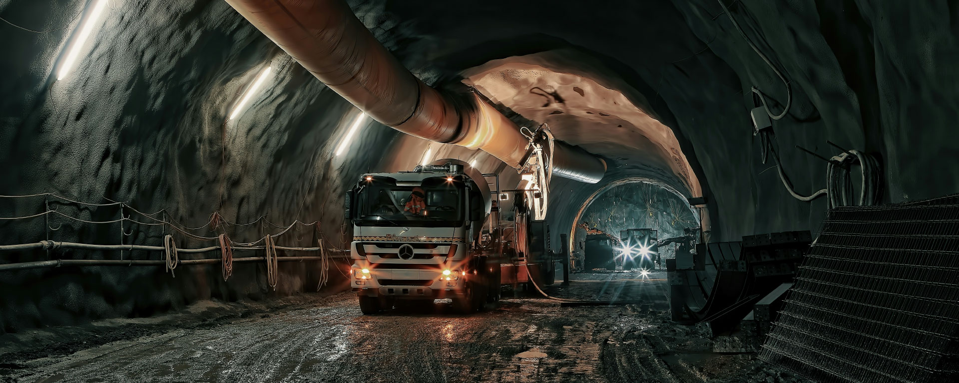
Geological engineering, the science of understanding and managing the behaviour of rocks, is essential for the safety and success of surface and underground constructions. From tunnels to mines to dam structures, the stability of these engineered structures depends on the understanding and characteristics of the rock properties. Hyperspectral imaging (HSI) can assist in this task. This is exactly what geologists from the Norwegian Geotechnical Institute (NGI) and the Norwegian University of Science and Technology (NTNU) investigated using hyperspectral images from HySpex.
The Challenge of Rock Degradation
Imagine constructing an underground passage only to find that the rock walls crumble and the ceiling swells, threatening the entire structure. This is a recurring nightmare for geological engineers who grapple with the challenges posed by rock degradation. Rocks, resilient as they seem, can under go significantchanges. Alterations caused by environmental agents, weathering, and metamorphism can weaken the strength of rocks, causing disintegration and swelling of different minerals by introducing water.
Understanding these complex processes is no trivial task. Traditionally, tools like X-ray diffraction (XRD) analysis, among others, are used to diagnose the composition and integrity of rocks. However, XRD has its limitations. It struggles to identify non-crystalline rock components and the subtle textural properties of weathered and altered rocks. This is where hyperspectral imaging can assist.
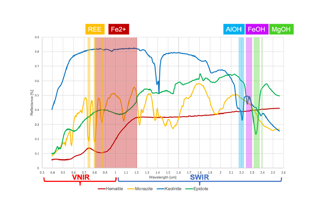
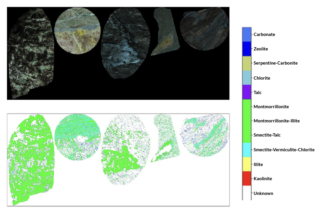
Hyperspectral imaging (HSI) relies on the unique spectral signatures of materials. Unlike XRD, it can capture the presence of amorphous minerals and even distinguish between different types of clay minerals. The initial surface degradation state of rocks can be visualized by scanning the rock surfaces as a proxy for overall rock stability. HSI demonstrated its potential to identify diverse minerals useful for geological engineering studies. In the shortwave infrared wavelength region (SWIR, ca. 1000 – 2500nm), mineral groups relevant to rock stability, such as micas, chlorite, and clayminerals, can be distinguished spectroscopically identifying distinct absorption features.
Empowering Geologists: Insights from a Pilot Study
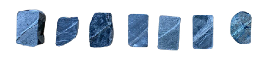
In a pilot study by Chiu et al., 2023 [1], geological engineers explored the potential of hyperspectral imaging using rock chip samples. By comparing the efficiency of hyperspectral imaging with traditional laboratory methods like XRD analysis and petrographic studies, the study highlights new ways to understand weak rock degradation. The technique explored here can operate in both laboratory and field settings, providing a holistic approach to geological investigations. One of the most exciting aspects in this study is HSI’s ability to trace microfractures by tracing mineral occurrence along spatially traceable features within the imaging data. These fractures, which are hard to trace conclusively by the naked eye, can indicate the future degradation potential of rocks. By mapping these fractures and identifying minerals associated with degradation, geological engineers canpredict and manage stability issues more effectively.
But why is a new method like hyperspectral imaging needed? Cost and time are critical concerns in any engineering project, and the accuracy of geological predictions during the planning phase is paramount. Many traditional methods are destructive, labour-intensive, time-consuming, and only based on sparse point measurements. A method that offers real-time insights over larger areas of the initial degradation state of rocks and empowers engineers on-site is a game-changer. Hyperspectral imaging can provide this new lens to examine rock stability, enabling engineers to foresee potential challenges and make informed decisions.
We thank Jessica Chiu and the NGI for allowing us to review her publication in this format. We would also like to thank NTNU and Statkraft AS for providing the samples, and master student Lisa Henriksen for assisting with the laboratory work within the publication. This work is supported by NGI via STIPINST PhD grant from the Research Council of Norway (no. 323307), Bever Control AS, and Bane NOR.
NGI is a research institution with expertise in geo technical engineering and geological investigations, dedicated to delivering innovative and practical solutions for complex engineering challenges.
Download this application note →
REFERENCES
[1] Chiu, J. K., Selen, L., & Koerting, F. (n.d.). Potential Applications ofHyperspectral Imaging on Weak Rock Degradation Studies in Engineering Geology. In Geo-Congress 2023 (pp. 11–21).
https://doi.org/10.1061/9780784484678.002
https://ascelibrary.org/doi/10.1061/9780784484678.002
[2] Kokaly, R.F., Clark, R.N., Swayze, G.A., Livo, K.E., Hoefen, T.M., Pearson, N.C., Wise, R.A., Benzel, W.M., Lowers, H.A., Driscoll, R.L., and Klein, A.J., 2017, USGS Spectral Library Version 7: U.S. Geological Survey Data Series 1035, 61 p.,
https://doi.org/10.3133/ds1035
Title image by Ricardo Gomez Angel from Unsplash


