
Hyperspectral LiDAR represents an advanced remote sensing technology that combines the three-dimensional measurement capability of LiDAR with spectral analysis similar to hyperspectral imaging. By integrating range-resolved laser measurements with wavelength-dependent information, hyperspectral LiDAR systems provide both geometric and material-related data from the same scene.
This approach extends traditional LiDAR from purely structural mapping toward quantitative surface and material characterization.
What Is Hyperspectral LiDAR?
Conventional LiDAR (Light Detection and Ranging) systems measure distance by emitting laser pulses and recording the time it takes for the reflected signal to return. The result is precise 3D information about terrain, objects, and structures.
Hyperspectral LiDAR adds a spectral dimension to this process. Instead of measuring only the intensity of the returned signal at a single wavelength, the system captures wavelength-dependent information from multiple spectral channels. This allows the sensor to collect:
- Spatial geometry (3D structure)
- Spectral response of surfaces
The combination of these datasets provides richer information than either LiDAR or hyperspectral imaging alone.
How Hyperspectral LiDAR Differs from Hyperspectral Imaging
While both technologies involve spectral measurement, they operate differently.
Hyperspectral imaging is typically a passive technique that measures reflected sunlight or artificial illumination across many narrow spectral bands. It produces a hyperspectral image where each pixel contains a full spectrum.
Hyperspectral LiDAR, by contrast, is an active system. It uses laser illumination and measures the spectral characteristics of the returned signal along with precise distance information. This enables:
- Operation independent of ambient light
- Direct coupling between geometry and spectral properties
- Improved analysis in complex or shaded environments
These characteristics make hyperspectral LiDAR particularly interesting for advanced remote sensing applications.
Key Capabilities of Hyperspectral LiDAR Systems
A hyperspectral LiDAR system can provide:
- High-resolution 3D surface models
- Spectrally resolved reflectance or backscatter information
- Material discrimination linked to spectral features
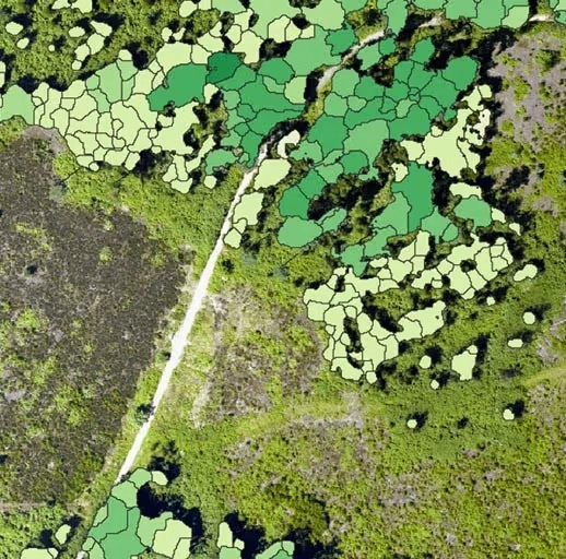
- Improved classification of vegetation, soil, and man-made materials
By combining structural and spectral data, the technology supports both mapping and analytical tasks in a single sensing workflow.
Applications of Hyperspectral LiDAR
Hyperspectral LiDAR is an emerging technology in fields such as:
- Environmental and ecosystem monitoring
- Vegetation and forest analysis
- Geological and surface material studies
- Infrastructure and terrain mapping
- Research in advanced remote sensing
In these applications, the ability to link spectral properties to precise 3D positions improves modeling accuracy and classification performance.
Relationship to Hyperspectral Imaging and Spectral Instrumentation
Hyperspectral LiDAR builds on the same fundamental principles as hyperspectral imaging: materials interact with light in wavelength-dependent ways. The design of systems that can measure subtle spectral differences reliably requires advanced expertise in:
- Optical design
- Spectral calibration
- Sensor stability
- Signal processing
Organizations with deep experience in hyperspectral imaging systems and imaging spectrometer technology, such as HySpex, contribute to the broader field of spectral remote sensing through their focus on high-quality optical and spectral measurement solutions.
Hyperspectral LiDAR as Part of Future Remote Sensing Systems
As remote sensing evolves, the integration of geometric and spectral sensing is becoming increasingly important. Hyperspectral LiDAR represents one path toward more information-rich sensing systems capable of delivering both structure and material insight.
Together with hyperspectral imaging technologies, these approaches expand the ability to analyze the Earth’s surface and engineered environments with greater precision and detail.
Explore Advanced Spectral Remote Sensing Technologies
Understanding the relationship between geometry and spectral response is increasingly important in modern remote sensing. Technologies such as hyperspectral imaging and hyperspectral LiDAR highlight the growing role of spectrally resolved measurement in environmental analysis, research, and mapping.
HySpex develops high-performance hyperspectral imaging systems and spectral measurement solutions used in airborne, ground-based, and research environments. Our team works with researchers and technical users who require stable, high-quality spectral data for demanding applications.
If your work involves advanced spectral sensing or remote sensing system development, we can provide guidance on optical performance considerations, spectral measurement principles, and system integration aspects. Feel free to contact us for more information.
FAQ – Hyperspectral LiDAR
What is hyperspectral LiDAR?
Hyperspectral LiDAR is a remote sensing technology that combines laser-based distance measurement with wavelength-dependent information. It provides both 3D geometry and spectral characteristics of surfaces.
How is hyperspectral LiDAR different from traditional LiDAR?
Traditional LiDAR measures distance and signal intensity, typically at a single wavelength. Hyperspectral LiDAR captures information from multiple wavelengths, enabling material-related analysis in addition to structural mapping.
How does hyperspectral LiDAR differ from hyperspectral imaging?
Hyperspectral imaging is usually passive and measures reflected light across many spectral bands. Hyperspectral LiDAR is an active system that uses laser illumination and measures spectral properties of the returned signal along with precise range data.
What are the advantages of combining spectral and LiDAR data?
Combining spectral and geometric information improves classification, material identification, and modeling accuracy. It allows better interpretation of vegetation, soil, terrain, and built structures.
Is hyperspectral LiDAR widely used today?
Hyperspectral LiDAR is still an emerging technology, primarily used in research and advanced remote sensing studies. It represents a growing direction in integrated sensing systems.


